


Quabbin Reservoir: Unveiling the Man-Made Majesty of Massachusetts' Largest Lake
Natural geological processes did not form the Quabbin Reservoir. Instead, it's a carefully engineered creation born out of the growing need for a reliable water supply for Boston and surrounding communities. In the 1930s, the state of Massachusetts undertook a massive public works project, damming the Swift River and inundating four towns – Dana, Enfield, Greenwich, and Prescott – to create the Quabbin, as documented by the Massachusetts Department of Conservation and Recreation (DCR), which manages the reservoir. This flooded area is known as the Swift River Valley.
Size and Scope: Massachusetts' Largest Body of WaterAs confirmed by the DCR, the Quabbin Reservoir is the largest inland body of water in Massachusetts. It has a surface area of approximately 39 square miles (25,000 acres) and a capacity to hold 412 billion gallons of water. It stretches over 18 miles in length and has 181 miles of shoreline. Its sheer size is a testament to the scale of the engineering project that created it. It has a maximum tax depth of 151 feet and an average depth of 51.
A Vital Resource: Supplying Water to Millions
The Quabbin Reservoir serves a critical purpose: providing drinking water to over three million people in greater Boston. It is the primary water supply for the Massachusetts Water Resources Authority (MWRA), which operates a sophisticated system of aqueducts and pipelines to deliver clean water to its customers, as detailed on the MWRA's website. The Quabbin and the Wachusett Reservoir form the backbone of this essential water supply system.
A Story of Loss and Transformation: The Submerged Towns
The creation of the Quabbin Reservoir came at a human cost. The four towns within the Swift River Valley were disincorporated and flooded, displacing their residents and forever altering the landscape. This story of loss and sacrifice is preserved in local historical societies and museums, such as the Swift River Valley Historical Society, which maintains a collection of artifacts and photographs from the lost towns. The reservoir's creation remains a poignant reminder of the complex trade-offs often associated with large-scale infrastructure projects.
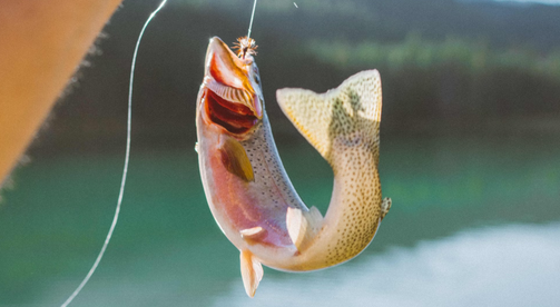
An Ecosystem Reborn: Wildlife and Recreation
Despite its artificial origins, the Quabbin Reservoir has become a thriving ecosystem. The surrounding watershed, primarily protected as a state forest, provides habitat for diverse wildlife, including deer, bears, coyotes, and numerous bird species, as noted by the DCR in their recreational guides. While access to the reservoir is restricted to protect water quality, limited fishing and hiking opportunities are available in designated areas. The reservoir is known for its populations of lake trout and landlocked salmon.
 The Quabbin Reservoir, Massachusetts' largest lake, is a remarkable example of human engineering intertwined with natural processes. Its vast size, vital role in supplying water to millions, and the poignant history of the submerged towns beneath its surface make it a unique and significant landmark. While born out of necessity and marked by a complex past, the Quabbin has become a valuable resource and a testament to the enduring power of nature to adapt and thrive. As the largest body of water in Massachusetts, the Quabbin Reservoir stands as a symbol of the state's ingenuity, commitment to resource management, and respect for the natural world.
Sources:
- Massachusetts Department of Conservation and Recreation (DCR)
- Massachusetts Water Resources Authority (MWRA)
- Swift River Valley Historical Society